Where the storms go
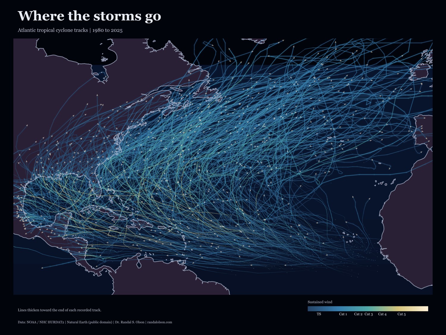
Atlantic tropical cyclone tracks from 1980 to 2025 on a dark basin map. Brighter tracks indicate stronger sustained winds; arrowheads mark the end of each recorded track.
Physical prints are made and shipped on demand. Shipping and taxes are calculated at checkout.
Read the story behind the chartAlso available as a desk mat.